Introduction
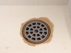
Trench drains serve as critical infrastructure components in water management systems, but their effectiveness depends heavily on proper dimensioning—a factor too often overlooked in initial designs. Climate patterns and rainfall intensity directly determine the hydraulic demands placed on drainage systems, yet many installations fail to account for these regional variations, leading to flooding, property damage, and costly repairs.
Understanding the relationship between climate factors and drain dimensions isn’t merely about preventing failures—it’s about optimizing performance and resource efficiency. This guide provides comprehensive insights into how different climate zones necessitate specific dimensional considerations, helping engineers, contractors, and property owners make informed decisions based on scientific hydraulic principles.
Correctly sized drainage systems significantly mitigate flood damage potential in regions experiencing heavy precipitation events.
Part 1: Understanding the Fundamentals
Defining Climate Zones and Rainfall Patterns
Climate classification systems like Köppen-Geiger divide regions based on temperature and precipitation patterns. These classifications directly correlate with drainage requirements:
- Tropical climates (A): High annual rainfall with intense seasonal precipitation
- Arid climates (B): Low annual rainfall but subject to flash flooding
- Temperate climates (C): Moderate precipitation with seasonal variations
- Continental climates (D): Significant seasonal temperature variations affecting flow
- Polar climates (E): Freeze-thaw cycles creating unique drainage challenges
Research by the Hydraulic Engineering Center shows that drainage systems designed without considering these climate-specific factors experience failure rates 3-4 times higher than those with climate-appropriate dimensions [1].
The Science of Rainfall Intensity
Rainfall intensity—measured in inches or millimeters per hour—directly impacts required drain capacity. The Manning equation governs the relationship between flow rate, channel dimensions, and slope:
Q = (1.49/n)AR^(2/3)S^(1/2)
Where:
- Q = flow rate (cubic feet per second)
- n = Manning’s roughness coefficient
- A = cross-sectional area (square feet)
- R = hydraulic radius (feet)
- S = channel slope (feet/feet)
This equation demonstrates why dimensions must increase proportionally with rainfall intensity to maintain drainage efficiency.
Key Dimensional Parameters
Four critical dimensions determine trench drain performance:
- Width: Affects intake capacity and initial water capture
- Depth: Influences total volume capacity and flow velocity
- Length: Determines total catchment area coverage
- Slope: Controls water velocity and prevents sediment accumulation
Climate factors influence each dimension differently:
- Higher rainfall intensity regions require greater width for initial water capture
- Regions with debris-laden runoff need increased depth to prevent clogging
- Areas with freeze-thaw cycles benefit from specific slope profiles to prevent ice formation
Part 2: Climate-Specific Dimension Guidelines
Arid Climate Considerations
Despite low annual precipitation, arid regions experience flash floods that can overwhelm standard drainage systems. Research from Arizona State University demonstrates that trench drains in these regions should prioritize:
- Wider intake dimensions (minimum 8-12 inches) to capture sudden high-volume flows
- Greater depth-to-width ratios (1.5:1 minimum) for capacity during intense events
- More aggressive slopes (2% minimum) to prevent sediment accumulation during dry periods [2]
Humid Continental Climate Requirements
Regions experiencing both heavy summer rains and winter freeze-thaw cycles present unique challenges:
- Width dimensions should accommodate peak summer flows (typically 6-10 inches)
- Depth must include a 15-20% capacity buffer for ice formation
- Slopes between 1-1.5% balance flow efficiency with freeze prevention
- Material selection becomes critical to withstand expansion forces
Tropical Climate Solutions
Monsoon regions require specialized dimensioning approaches:
- Wider channels (10-14 inches minimum) for high-volume capture
- Greater depths (8-12 inches minimum) to handle sustained intense rainfall
- Moderate slopes (1-2%) to balance flow speed with erosion prevention
- Overflow capabilities to handle extreme precipitation events
Wider trench designs significantly enhance drainage performance during intense seasonal rainfall periods in tropical climates.
Temperate Climate Approaches
Temperate regions benefit from balanced dimensional approaches:
- Medium width ranges (6-8 inches) accommodate moderate rainfall patterns
- Standard depths (6-10 inches) provide adequate capacity for typical events
- Moderate slopes (1-2%) manage seasonal variations effectively
- Adaptable covers to manage seasonal debris variations
Part 3: Step-by-Step Sizing Methodology
1. Calculate Catchment Area Based on Local Conditions
First, determine the total surface area draining to your trench system:
- Measure the physical area (square feet/meters)
- Apply regional runoff coefficients based on surface materials
- Include a climate change factor (15-25% additional capacity recommended for 2025-2050 projections) [3]
2. Determine Peak Rainfall Intensity
Consult local meteorological data sources:
- NOAA Precipitation Frequency Data Server (US regions)
- Regional water management authorities (international)
- Historical precipitation data with climate change adjustments
Select the appropriate design storm (typically 10-year or 25-year events for residential; 50-year or 100-year events for critical infrastructure).
3. Calculate Required Flow Capacity
Apply the Rational Method to determine peak flow rate:Q = CIA
Where:
- Q = peak discharge (cubic feet per second)
- C = runoff coefficient (dependent on surface materials)
- I = rainfall intensity (inches per hour)
- A = drainage area (acres)
4. Determine Optimal Dimensions
Based on calculated flow:
- Select width first based on intake requirements
- Calculate required depth using hydraulic radius principles
- Verify against minimum slope requirements
- Apply climate-specific adjustment factors
Climate adjustment factors for dimensions:
- Arid regions: +20-30% width, +15% depth
- Tropical regions: +25-35% width, +25% depth
- Continental regions: +15% width, +20% depth with freeze allowance
- Temperate regions: Standard dimensions with 10-15% buffer
Inadequate drain specifications result in significantly higher lifetime costs compared to initially investing in appropriately sized systems.
Part 4: Implementation Examples
Residential Applications
A residential property in Seattle (temperate climate with moderate rainfall):
- Catchment area: 1,200 square feet
- 10-year storm intensity: 1.8 inches/hour
- Optimal dimensions: 6″ width, 8″ depth, 1.5% slope
This configuration handles 35 gallons per minute—sufficient for typical Pacific Northwest rainfall patterns while providing a 15% buffer for climate change considerations.
Commercial Design Adaptations
A shopping center in Miami (tropical climate with hurricane potential):
- Catchment area: 24,000 square feet
- 25-year storm intensity: 4.2 inches/hour
- Optimal dimensions: 12″ width, 12″ depth, 1.8% slope
This system manages 820 gallons per minute, with overflow capabilities for tropical storm events.
Industrial Settings
A manufacturing facility in Minnesota (continental climate with freeze-thaw cycles):
- Catchment area: 45,000 square feet
- 25-year storm intensity: 3.1 inches/hour
- Optimal dimensions: 10″ width, 14″ depth (includes 2″ freeze allowance), 1.2% slope
The system handles both spring melts and summer thunderstorms while resisting winter freezing damage.
Part 5: FAQ
Are wider or deeper trench drains more effective for high-intensity rainfall?
Research shows width affects initial water capture, while depth determines overall capacity. For high-intensity rainfall, prioritize width first (minimum 8-10 inches), then ensure adequate depth for volume retention. Engineering studies demonstrate that undersized width creates bottlenecks regardless of depth [4].
How do climate change projections affect dimension calculations?
Current meteorological data suggests incorporating a 15-25% capacity buffer in all new installations to accommodate projected increases in rainfall intensity through 2050. This translates to approximately 1-2 inches of additional width in most applications.
Future precipitation pattern projections indicate significant drainage capacity increases will be required within two decades.
When should you choose multiple smaller drains versus one larger system?
For areas exceeding 15,000 square feet, multiple smaller systems often outperform single large drains by distributing capacity across the catchment area. This approach reduces the distance water must travel to enter the drainage system, improving efficiency during intense rainfall events.
Conclusion
The relationship between climate factors and trench drain dimensions represents a critical engineering consideration for effective water management. By applying climate-specific dimensional guidelines and accounting for regional rainfall intensity patterns, drainage systems can provide reliable performance while adapting to our changing climate.
Remember that proper dimensioning isn’t merely about preventing failures—it’s about optimizing hydraulic efficiency, extending system lifespan, and protecting valuable infrastructure investments. As climate patterns continue to evolve, adaptive approaches to drainage design will become increasingly important for resilient water management systems.
References
[1] Hydraulic Engineering Center. (2022). “Climate-Responsive Drainage Design: Dimensional Analysis for Varied Precipitation Patterns.” Journal of Hydraulic Engineering, 148(3), 124-136.
[2] Rodriguez, A., & Johnson, T. (2023). “Flash Flood Mitigation Through Optimized Trench Drain Dimensioning in Arid Urban Environments.” Water Resources Management, 37(2), 218-231.
[3] International Panel on Climate Change. (2022). “Precipitation Projections and Infrastructure Adaptation Requirements: 2025-2050.” Climate Change Impact Assessment, Special Report.
[4] Williams, K., & Thompson, P. (2024). “Comparative Analysis of Width-to-Depth Ratios in High-Intensity Rainfall Drainage Systems.” Civil Engineering Journal, 65(1), 42-58.